Day 35, May 20, Oh my, P.E.I.!
- randolf50
- May 20, 2022
- 5 min read
Updated: May 22, 2022
On day thirty-five, we got a slow start getting ready to leave -- mainly because Doug slept late. Patrise had arisen early, about 4am, and so, she went out and walked the beach at sunrise. Here is what she saw.


ISN'T THIS GLORIOUS!!!
Breakfast was French toast, after which we organized ourselves for leaving, heading to the bridge that would take us to Prince Edward Island (hereinafter referred to by its acronym, PEI.)

Crossing the Confederation Bridge (as it is known in Canada) was an experience in itself. It is a two-lane bridge, one lane in each direction, with a speed limit of 80 km/hr or 50 mph. With a length of 8 miles or 13 km, it takes 10-12 minutes to cross over beautiful blue water, the Abegweit Passage of the Northumberland Strait. It is the longest bridge in Canada and one of the longest in the world. The bridge's name derives from the fact that Canada's founding fathers held their first meetings in Charlottetown, PEI, to form the confederation. Those meetings were in 1864, but the bridge was not built until the 1990's (opened in 1997.).
Here is a map of where the bridge touches PEI, along with some photos taken during our crossing.


This area is in New Brunswick, immediately before the ascension to the bridge.

Looking north while crossing the bridge. You can barely make out PEI in the distance.

Looking south while crossing the bridge. No land in sight.

Approaching the PEI landing (looking south)

Approaching the PEI landing (looking north)

A PEI information center (centre), as soon as you land onto the island.
We proceeded to make our way to Charlottetown, the capitol of Prince Edward Island. (Remember, even though it is an island, PEI is an independent province, like Hawaii is an island state as a part of the U.S.) What struck us immediately was how rural the island is and how much agriculture is an essential part of its fabric. As we later learned, agriculture is a HUGE part of the island's economy, along with fisheries, tourism, and -- wait for it -- aerospace! The predominant crop grown on the island is potato, making up 50% of the cash value of all of the island's crops. Aerospace? you ask. Same reaction we had, but that is what the island's official information site says. Who are we to argue?
Here are some of the island's landscapes and views, as we captured them on the way to Charlottetown.

(PEI farm scene)

(PEI farm scene)

(PEI farm scene)

(PEI farm scene)

(On the road to Charlottetown)

(On the road to Charlottetown)

(On the road to Charlottetown)

(A church on the road to Charlottetown)

(On the road to Charlottetown)

PEI farm scene)
Once we reached Charlottetown, we were immediately taken by its vibrancy and its charm. We did not have time to take an official tour. Still, we parked in the historic downtown district and walked several blocks to have lunch at the restaurant Patrise had found earlier. The Water Prince Corner Shop and Lobster Pound is considered one of the top seafood restaurants on the Island, although it is very small and homey. Based on our lunch, it certainly lives up to its reputation.

Water Prince Corner Shop, where we ate lunch

This little recognition is tucked away in an easily overlooked place in the restaurant.

The owner of the restaurant, answering a question for Patrise.

Waiting for the appetizers to come.

The mussels were off the chain good!!! (So were the clam chowder, the lobster roll and the fried clams)

A satisfied customer from Georgia

Some of the quirky charm of the Water Prince...
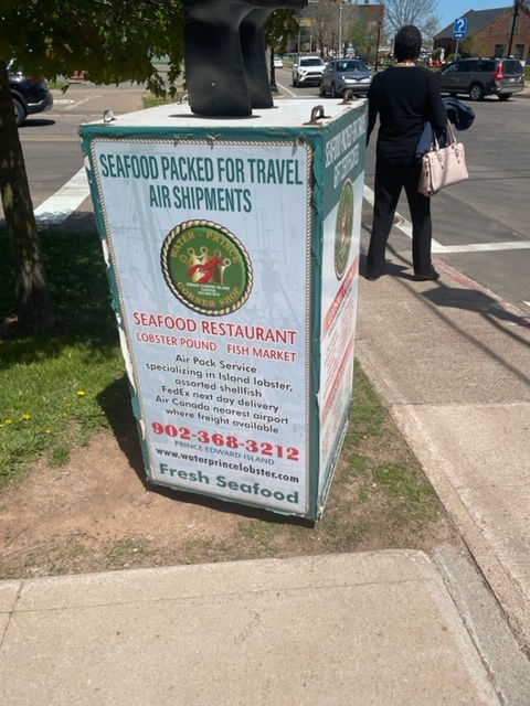
The restaurant is known by locals for this box with upside down galoshes on top, which stands immediately outside of the restaurant.
After lunch, we walked around more of the historic district and the water front. Here are a selection of the pictures we took before and after lunch.

(Downtown Charlottetown)

(Downtown Charlottetown)

(Downtown Charlottetown)

(Downtown Charlottetown)

(Downtown Charlottetown)

(Charlottetown looks forward to hosting the Canada Games next year.)

(Downtown Charlottetown)

(A different kind of "NFL")

(The waterfront in Charlottetown)

(The waterfront in Charlottetown)

(The waterfront in Charlottetown)

(Historic Charlottetown map)

(The waterfront in Charlottetown)

(Downtown Charlottetown. The business office where prohibition emanated in Charlottetown. Canada's period of prohibition began on Prince Edward Island. Every morning, local officials would open barrels of confiscated alcohol and pour it in the street in front of this office. At the same time, liquor that was to be exported was held under lock and key in this same place. Needless to say, not a popular circumstance for the local populace. Read the inscription on the historic plaque shown below.)

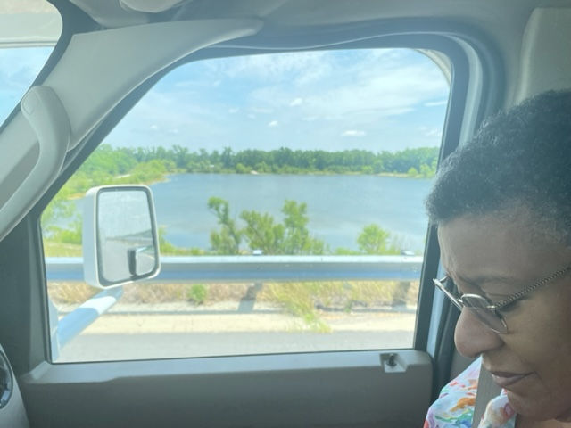
After this, we left Charlottetown and drove across the island to our next stay, a resort facing the Atlantic Ocean. We actually drove past the turnoff and found ourselves at a dead end on a road leading to a national park -- the Greenwich National Park. We called the resort, got clearer directions and then drove back to where we were supposed to have turned, eventually making our way to the Rodd Crowbush Golf & Beach Resort. It is a wonderful facility, and Doug was very surprised at how elegant it was -- tucked away off the road from a very earthy town on the island.

We drove from the lower left corner on the map to Charlottetown in the mid-right of the map.

(After lunch, we continued to drive over to the over side of the island. We were supposed to go directly to Crowbush Cove (top left of the island). Instead, we all the way down Hwy 2 to county road 313 to the green tip area at the top center of the map. We had to drive all of the way back. LOLOL)
We set our things down, and without unpacking, we immediately went for a long walk to the beach, then the clubhouse, then back to the hotel. The staff has been nothing less than very helpful, warm and friendly. It turns out that there are still a lot of things they are trying to learn or figure out themselves, because today was the first day the hotel is opened for the season! We had a drink at the clubhouse while watching the ocean and talking with some of the staff. Then, upon returning to the hotel, we had dinner, as the very first patrons they have for the 2022 season.
Here are photos of our room, of the hotel, of the beach, and then the restaurant.


(Crowbush hotel lobby area, looking out to the golf course)

(Our hotel room living area)

(Hotel room bedroom area)

(Wonderful tile treatment in the bathtub/shower)

(Buildings for rent on the property)

(Path to the beach)

(The beach access partially goes through this green, tree covered area.)

(TA DAH! The beach is reached.)

(Obligatory selfie on the beach -- Patrise obliges Doug with all of the selfies.)

(Looking east down the beach)

(Panorama photo of the beach)

(The hotel as seen from the back of the golf clubhouse)

(Inside the hotel restaurant.)

(Last selfie of the day.)
After dinner, we returned to the room and settled in for the evening, looking forward to tomorrow and getting a massage for each of us.

Comments